By Mrs Martin (Head of Year 3)
Year 3 embarked on an exciting journey to explore the rich history and evolving landscape of Bedford. Armed with maps and a curious spirit, the girls delved into the past to uncover the secrets of how our town has transformed over time.
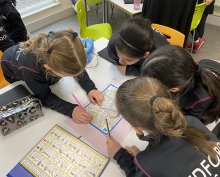
The lesson began with observation and research skills at the forefront. Divided into groups, the girls were given maps of present-day Bedford and set out to identify familiar landmarks and features. With keen eyes they investigated the maps, pointing out streets, parks, rivers and other distinguishing characteristics that make Bedford our home.
Next, armed with maps from the 1800s, the girls began an intriguing comparison between the past and present. They meticulously analysed the two maps, noting similarities and differences in street layouts, land use, and prominent landmarks. It was a journey through time as they traced the evolution of Bedford's landscape. Using their newfound knowledge, the girls created Venn diagrams to visually represent the intersection of features between the two time periods, gaining a deeper understanding of how Bedford has evolved over the centuries.
The investigation revealed Bedford's name origins, tied to its location on the River Great Ouse. Research suggests "Bedford" originates from Old English, "bedec" meaning "bed," and "ford" for shallow river crossing. It may also relate to Saxon Chief ‘Beda,’ highlighting its historical significance as a crossing point.
Year 3’s journey through Bedford's past enhanced their geography skills and strengthened their connection to the local community's rich heritage.


