By Mrs Inkson (Head of Year 6)
As part of our Unit of Inquiry on human migration, Year 6 has been developing their geographical skills, learning about maps. This week, we focused on contour lines, employing practical activities to allow the girls to connect with geography on a more hands-on level.
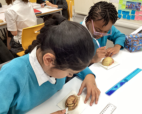
In the first lesson, the girls were asked to draw contour lines onto half a potato, providing them with an opportunity to visualise how these lines appear on a map when viewed from the top. It was a simple yet effective way to bridge the gap between theory and practical application.
After working with the potato, the girls used playdough to create three-dimensional models of hills and mountains. They copied contour lines from real maps, helping them understand how these lines represent changes in elevation on the land.
They then moved on to using their inquiry skills to explore how the physical features of an area affect the route migrants take on their journeys. This investigation added a real-world context to their understanding of geography and migration.
Overall, the lessons deepened their understanding of geographical concepts but also encouraged critical thinking about how physical landscapes impact human migration.


.jpg&command_2=resize&height_2=85)


